
The cold arrived almost rudely, like someone slamming a door in the middle of the night. On Tuesday, people were walking dogs in thin jackets, kids dragging their feet through half-melted leaves. By Thursday morning, windshields were crusted in ice thick enough to scrape with a credit card, and the air burned the inside of your nose. The forecast apps didn’t just turn blue, they went violent purple.
On local TV, a meteorologist pointed at a map bleeding deep navy and said quietly: “This is not a normal plunge.”

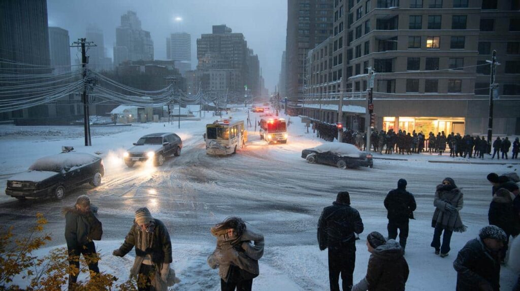
Out on the street, the city didn’t look ready at all.

Something about this cold feels… different.

A historic plunge, or just winter doing its thing?
Across weather dashboards and late-night maps, one phrase keeps popping up: brutal temperature plunge. Not just a chilly front, but a fast, almost vertical drop that could shove huge swaths of North America and Europe into sub-zero territory in less than 48 hours. Meteorologists talk about air “spilling” out of the Arctic like someone tipped the globe and forgot to set it back upright.
For many, that sounds suspiciously like last year, and the year before, and the year before that. Yet this time, some forecasters are saying the quiet part out loud. This one could rewrite parts of winter storm history.
If you lived through the February 2021 Texas freeze, you might feel a faint twitch reading those words. That week, more than 200 people died, pipes burst across neighborhoods, and the power grid buckled like a cheap lawn chair. It wasn’t just a cold snap; it was a slow-motion civic failure under a sky that looked painfully clear.
Now imagine a similar Arctic blast, but stretched over more cities, and colliding with wetter storms and overloaded infrastructure. Some models show temperature drops of 25–35°F in a single day across the Midwest and Northeast, the kind that turn slush into black ice before rush hour is even over. One bad timing window, and everything clogs.
Meteorologists aren’t all lining up on the same side of this forecast. Some are calling the upcoming pattern a once‑in‑a‑generation clash between polar air and an amped-up jet stream. Others say the hype feeds on short social media clips, ignoring that forecasts at 10–15 days carry heavy uncertainty. Both can be true at once.
The tricky part is that climate change shifts the background conditions. Warmer oceans can fuel stronger storms, while a wobblier polar vortex may send more cold south at weird times, in weird ways. So you end up with a “normal winter” that doesn’t feel remotely normal, and a coming cold wave that might be either overblown… or the test our cities fail loudly.
The quiet cracks in “modern” cities
Talk to city engineers off the record and they’ll admit something that rarely makes press conferences: a lot of our cold-weather planning is built on yesterday’s climate, not today’s chaos. Sewer systems sized for historical snowfall, road salt budgets based on 30-year averages, power lines strung for heatwaves and storms that no longer behave on schedule. When a plunge like this hits, corners cut years ago suddenly matter.
The brutal part isn’t just the cold. It’s the speed. A 30-degree swing in a day stresses concrete, rails, and old steel like a physical stress test nobody signed up for.
Take Chicago, one of the cities that actually prides itself on “knowing winter.” After a rapid freeze a few years back, train lines seized as frozen switches malfunctioned, crews literally setting tracks on fire to keep them working. On the South Side, residents queued for hours at a single warming center that had already run out of cots. Plows focused on major arteries; side streets turned into glossy ice tunnels where ambulances crawled.
Farther south, where extreme cold isn’t routine, the cracks are even sharper. In Atlanta’s 2014 snow-and-ice gridlock, hundreds slept in cars on frozen highways, not because the storm was historic in size, but because the city wasn’t wired to adapt quickly. A similar plunge today, tied to heavier snow bands or freezing rain, could turn those same weaknesses lethal.
Urban planners call these “cascading failures.” First the roads get slick, then the accidents snarl traffic, then emergency vehicles can’t get through, then hospitals start to fill, just as parts of the grid sag under demand. All this while some pipes freeze and burst, taking out water in pockets that were already vulnerable.

When meteorologists warn that this next plunge could “rewrite winter storm history,” this is what they mean. Not a single cinematic blizzard, but a cluster of simultaneous breakdowns in cities designed around the idea that tomorrow will look roughly like yesterday. *The science is complex, but the lived experience ends up brutally simple: can you still get heat, help, and safe roads when the temperature falls off a cliff?*
How to get ready when the experts don’t agree
Let’s stay practical for a moment. The forecast might be overblown. Or it might not. The one thing you control is what you do before the cold slams into your street. Start with a 48-hour mindset: if you had to ride out two days of power cuts and icy roads, what would you actually need? Not a bunker, just a buffer.
That looks like: backup light that doesn’t rely only on your phone, extra blankets stacked where you can find them half‑asleep, and at least a couple of days of food that doesn’t need much cooking. Tape a short list by the door: gloves, hat, charger, a small bottle of water, meds. The basics are boring until the moment they aren’t.
We’ve all been there, that moment when you realise the forecast was right only once your feet are already wet and cold on the sidewalk. It’s easy to shrug off weather warnings after a few “busted” storms, especially when some headlines sound like doomsday trailers. Skepticism is healthy; total dismissal is not.
One gentle rule: prep for discomfort, not for disaster movies. That means protecting the things that fail first in a deep freeze—exposed pipes, car batteries, and your own fingers and toes. Drip indoor faucets on exposed lines, park your car facing out, lay out warm layers the night before. Let’s be honest: nobody really does this every single day. But doing it for the specific nights when forecasters are visibly nervous? That’s different.
This split between experts and skeptics is playing out loudly online. Some meteorologists are begging people to take the plunge seriously; others are publicly urging caution about “storm hype.” City officials fall somewhere in the middle, wary of over-alerting and then being mocked if the storm shifts.
Inside that tension, individual voices cut through:
“Forecasts are probabilities, not promises,” says one veteran forecaster from the National Weather Service. “When we sound the alarm, it’s not because we know exactly what will happen. It’s because we see how bad it could get if we’re even mostly right.”
- Check your local forecast twice in the 72 hours before the cold hits, not just a national app.
- Walk your home with fresh eyes: drafty windows, exposed pipes, a door that doesn’t quite close.
- Talk to neighbors, especially older or isolated ones, about swapping updates or sharing heat if outages hit.
- Back up your essentials: prescriptions, baby supplies, pet food, portable chargers.
- Create a tiny “if the power goes” plan: one warm room, one light source, one way to stay informed.
What this winter is quietly asking us
The coming temperature plunge is more than just a storyline for dramatic forecast maps. It’s a stress test of how honestly we’ve been talking about risk, resilience, and who gets left shivering when things go wrong. Some experts will be right. Some skeptics will be right. The weather will still do whatever the atmosphere decides.
What remains is the lived reality: people pacing dark apartments, bus drivers easing through invisible ice, mayors praying the grid holds while crews work overtime. Cities like to present themselves as sleek, modern, optimized. Yet a few days of wild cold can strip that story back to something older and rawer—heat, shelter, community, and the quiet math of who has what.
This winter might not break every record. It might not match the most viral warnings. But it lands in a time when extremes are stacking on top of each other, and patience with “once‑in‑a‑lifetime” explanations is wearing thin.
The real question isn’t whether this storm rewrites winter history on paper. It’s whether we let it rewrite our sense of what being “ready” really means, from city hall down to the single light left on in your hallway at 3 a.m.
| Key point | Detail | Value for the reader |
|---|---|---|
| Rapid temperature plunge risk | Forecast drops of 25–35°F in 24–48 hours across major regions | Helps you understand why this cold wave feels different from a normal chill |
| Urban system weaknesses | Grids, roads, and pipes designed for past climate averages facing new extremes | Shows where cities may fail first, so you can anticipate local problems |
| Personal resilience steps | Simple 48-hour prep: warmth, light, water, neighbor check‑ins | Gives concrete actions that matter regardless of forecast uncertainty |
FAQ:
- Will this cold wave be as bad as the Texas freeze in 2021?Some regions could see similar temperature drops, but impacts depend on local grids, preparedness, and whether ice or snow accompanies the cold. The pattern looks serious enough that officials are watching it closely, even if exact outcomes are still uncertain.
- Are meteorologists exaggerating for clicks?Some online headlines stretch the language, yet most professional forecasters base their warnings on model consensus and risk ranges. When they highlight “historic potential,” it usually refers to how unusual the setup is compared to past data, not guaranteed catastrophe.
- How early should I start preparing at home?Begin low‑stress steps—checking supplies, sealing drafts—about 3–5 days before the cold is expected, then tighten plans 24–48 hours out when forecasts sharpen. That way you’re ready without panic‑buying or rushing.
- What matters more: snow totals or temperature?Both matter, but for city function, the dangerous combo is rapid freeze with wind and any mix of sleet or freezing rain. A dry, bitter cold strains power demand and health; icy layers trigger crashes, outages, and access problems.
- How can I help if my city isn’t well prepared?On the micro level, create a small support loop with neighbors and share accurate local forecast info. On the larger scale, push your city or town to publish cold‑weather response plans, upgrade infrastructure, and review what went wrong after each major event.